


Voting District 0856444000011, Lake County, Michigan
About
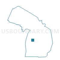
Outline

Summary
| Unique Area Identifier | 597537 |
| Name | Voting District 0856444000011 |
| County | Lake County |
| State | Michigan |
| Area (square miles) | 35.51 |
| Land Area (square miles) | 35.47 |
| Water Area (square miles) | 0.04 |
| % of Land Area | 99.89 |
| % of Water Area | 0.11 |
| Latitude of the Internal Point | 43.94087200 |
| Longtitude of the Internal Point | -85.60802310 |
Maps


Graphs
Select a template below for downloading or customizing gragh for Voting District 0856444000011, Lake County, Michigan


Neighbors
Neighoring Voting District (by Name) Neighboring Voting District on the Map
- Voting District 0851488000001, Lake County, MI
- Voting District 0851510000002, Lake County, MI
- Voting District 0852544000006, Lake County, MI
- Voting District 0855748000008, Lake County, MI
- Voting District 0858904000019, Lake County, MI
- Voting District 1334712000001, Osceola County, MI
- Voting District 1334772000001, Osceola County, MI
- Voting District 1336844000001, Osceola County, MI
Top 10 Neighboring County Subdivision (by Population) Neighboring County Subdivision on the Map
- Richmond township, Osceola County, MI (1,554)
- Lincoln township, Osceola County, MI (1,500)
- Le Roy township, Osceola County, MI (1,212)
- Chase township, Lake County, MI (1,137)
- Ellsworth township, Lake County, MI (817)
- Yates township, Lake County, MI (761)
- Pinora township, Lake County, MI (717)
- Newkirk township, Lake County, MI (632)
- Cherry Valley township, Lake County, MI (396)
Top 10 Neighboring Unified School District (by Population) Neighboring Unified School District on the Map
- Reed City Area Public Schools, MI (10,776)
- Baldwin Community Schools, MI (8,209)
- Pine River Area Schools, MI (7,662)
Top 10 Neighboring State Legislative District Lower Chamber (by Population) Neighboring State Legislative District Lower Chamber on the Map
Top 10 Neighboring State Legislative District Upper Chamber (by Population) Neighboring State Legislative District Upper Chamber on the Map
Top 10 Neighboring 111th Congressional District (by Population) Neighboring 111th Congressional District on the Map
Top 10 Neighboring Census Tract (by Population) Neighboring Census Tract on the Map
- Census Tract 9706, Osceola County, MI (4,165)
- Census Tract 9702, Osceola County, MI (4,024)
- Census Tract 9611, Lake County, MI (3,617)
- Census Tract 9703, Osceola County, MI (3,115)
- Census Tract 9613, Lake County, MI (2,838)